
Kennis /
Verslag Mobile Habits Talkshop
Mobile Habits
— De Mobile Habits dag in de Balie begon met een Talkshow onder leiding van Esther Polak.
The morning session of the Mobile Habits Talkshop was presented like a 'talk show' hosted by Esther Polak. She found out what inspires artist Christian Nold, talked with Hanne Kirstine Adriansen about the complex relationship between mobile lifestyles and the way we experience identity. And finally she joined up with Ad Drent for a Q & A on social theories on mobility.
The 'Mobile Habits' workshop was an interdisciplinary examination of the development of locative media projects in artistic and scientific fields. Visual artist (and host) Esther Polak, talked about her enjoyment at putting people "on a stage" with her locative media project 'AmsterdamREALTIME: Diary In Traces'. The project enabled sixty inhabitants of Amsterdam to carry a GPS tracer with them for one week in 2002 and map their daily routes. Christian Nold, a British visual artist who, with a project called 'Biomapping', explores physiological arousal during daily routes (or 'walks'), suggested wryly that artists are quick to draw people's attention to the question without intending to give an answer. Polak had become interested in the science of mobility when realizing her second GPS project, 'MILK', which followed European dairy transport from the udder of the (Latvian) cow to the mouth of the (Dutch) consumer. Her research brought her in contact with Danish geographer Hanne Kirstine Adriansen who had carried out field studies into the Senegalese Fulani (cattle herders). Polak also discovered that Dutch ecologist/anthropologist Ab Drent had conducted field studies in Africa with Cameroonian Fulani. Both Adriansen and Drent used GPS (Global Positioning System) data to complement GIS (Geographical Information Systems) data and construct an informed line of investigation into the mobile habits of the Fulani.
Polak hosted the morning of interdisciplinary presentations and lead the group through a drawing activity. She and Nold co-presented the morning and lead the group into a consideration of the various artistic, scientific and sociological influences on their own work. Polak then invited Hanne Kirstine Adriansen to give a presentation of her experiences in Senegal, explaining the interest she acquired in Adriansen's studies. Polak was keen to develop her own understanding of the abstract terms Adriansen used as starting points for developing her theories on mobility. Finally, Polak invited Ab Drent to present for the group; the template was similar to the Polak/Adriansen presentation, in that Polak allowed Drent to present his study to the group whilst she interjected her own findings in his work and other useful generalisms about locative media projects. Throughout the morning, Polak was keen not only to host the presentations but also to assist the speakers in relaying their complex ideas about mobility to the group both verbally and visually.
Adriansen considers GPS data, which is spatio-temporal information, to work well when complementing other spatial data-types. An everyday example of this could be observed in Just van den Broecke's project, 'Geoskating' (2005-06). Van den Broecke, who was present, had encouraged inline skaters to use affordable GPS systems and mobile phones to locate, photograph, and rank skateable pavements in North Holland. This data was presented in an interactive online map (constructed with T-Label), and if a user selected a GPS point on the map, then it was usually possible to see short films or photographs of the area skated, and close up photographs of pavements. The 'Geoskating' interface, visual information correlated to GPS points, is typical of how spatio-temporal information is used within what Nold considers the "locked language" of maps. A similar usage is found in 'Open Street Map', where users are encouraged to author their own routes on existing maps. This process, argues Nold, is not only corrective but also expressive; it also has a clear similarity with the work of Polak in 'AmsterdamREALTIME'. Nold suggested that the projects presented types of "urban liberation" in their visualisations as both 'Geoskating' and 'Open Street Map' are communal projects that attempt to re-conceptualise geographic space for their users. In doing so, they reject the fixity of the traditional types of geo-data (maps) we usually rely on.
'This Way Brouwn' (1969), a collaborative project between conceptual artist Stanley Brouwn and five hundred inhabitants of Amsterdam was an influence on 'AmsterdamREALTIME'. Brouwn collected the inhabitant's drawings of their daily routes and exhibited them. In response to the abstract scrawls of routes that frequent Brouwn's project, Nold suggested that locative media attempts to add new layers of understanding to the simplistic representation of a route taken by the individual. In his own project, a 'walk' is represented by a three-dimensional rendering of the individual's 'physiological arousal' in a two-dimensional map. Polak's project presents routes that can be traced in real-time by the user, which connect to form a ghostly outline of Amsterdam and fade as the map 'ages'. Polak also collected biographical data and recalled a participant who hoped the project would show how fast he could cycle. Unfortunately for him the ethereal visualisation of the project does little to convey speed.
This disparity between geo-data and individual experience affected Adriansen in her studies. She discussed transhumance (the seasonal movement of livestock between upland and lowland pastures); for Senegalese pastoralists ( Fulani), the use of the watering point would differentiate between cattle movement being transhumance or not. If cattle have a familiarity with an area then the herdsmen may allow them to roam freely knowing that they will, generally speaking, return to the watering point. By using the geo-data as a catalyst for an informed line of questioning, Adriansen learnt that the senior pastoralists often stayed local to the watering point, leaving their sons and other family members to oversee the herd (if necessary). This meant that geo-data of cattle movement did not always imply transhumance.
Nold, perhaps owing to our urban location, discussed at length the difficulties of projecting mobility in the city. Using Polak's 'AmsterdamREALTIME' as a starting point, Nold walked the audience through Victorian industrialist Charles Booth's pioneering sociological 'Poverty Map of London', and later The Institute of Applied Autonomy's map of surveillance systems in New York (1998-2002).
Nold felt that 'The Poverty Map of London' (1886-1909), was a point of departure for his own ideas about mobile habits in his project, 'Biomapping'. Police officers collected the data for the poverty map, making notes as they walked through London. The map used colour coding to show the condition of a street's inhabitants but, argues Nold, the map became a reduced representation of the notebooks, which contained recurring characters and other anecdotal evidence that revealed a rich cross-section of life in London.
A dense map that uses 'pull out' screens to make its geo-data more accessible, The Institute of Applied Autonomy's map uses a routing algorithm to select a two-point route that minimises surveillance. The visualisation of the map emphasises the built environment of the city and is far removed from the fluid lines of mobility featured in Polak's project, or the scattering of colour coded movement in Adriansen's GPS/GIS maps. Nold also introduced the work of artist Marco Peljhan who works with surveillance aspects of geo-data, constructing dystopian installations that engage with various urban anxieties. Polak countered that her project enabled people to deconstruct their anonymity, to relocate their identity within the city. Nold felt that his own goal with 'Biomapping' was to visualise internal communities; he wants people to use his device (a similar technology to the lie detector with additional GPS tracking system) to walk and explore built environments but without projecting subjectively onto the resulting geo-data. Therefore, Nold's project was visualised in two distinct ways: firstly, the peaks and troughs of physiological arousal were mapped three dimensionally onto a two-dimensional map of Greenwich; secondly, in a much larger visualisation called the 'Emotion Map', swells of physiological arousal within the Greenwich community are represented by ribbons of colour. A near abstraction were it not for the familiar language of a traditional map, this particular visualisation affirms his desires for people to subjectify experiences but with responsibility as the interaction people have with each other being more important than the built environment is central to Nold's thinking, and this was evident not only in his own work but also in the work he revealed to us as being inspirational for himself. Nold also sees the user-friendly system being used practically, helping children with Attention Deficit Hyperactivity Disorder to document their experiences out of doors with what could be a useful, interactive tool for their maturation into young adults, is one such example of the sociological thinking that permeates his art.
The group then left the city with Ab Drent, who worked with the Fulani in North Cameroon, to experience at first hand whether or not the mobile lifestyle was a tragedy. Much like Adriansen being able to use GPS data as a means to interrogate established ideas about pastoralists, Drent explored the effectiveness of "non-equilibrium ecologies". He found that researching people's mobility enabled a process of reflection, and this is itself a clear component of the visual art of Polak and Nold. Drent added that mobility often resembled "chaos" in practice, with pastoralists moving frequently, and converting space (impersonal) into place (personal) to make camp.
To make sense of extreme mobility, Drent presented a scientific model, Actor Network Theory (ANT). ANT consists of six basic categories: agency; mobility; collective; translation; enrolment; method. To simplify, each category represents a component of a community. Drent illustrated how two of these components interacted when women refused to perform their duties in camp; their removal from the agency meant that camp could not be constructed, cattle would not be milked, and milk would not be sold at market; a woman then ignoring their responsibilities affects the mobility of the pastoral unit.
It came as pleasant surprise to discover that we had been involved in an actor network during the morning's drawing exercise. With felt tip pens and paper, we were encouraged to draw our routes to the location freely, expressing physiological and physical aspects of our journeys. The visualisation of our routes ranged from simplistic line-renderings to annotated and illustrated 'stories'. As Polak called each 'artist' out to discuss the dual decision-making process of travelling the route and visualising it, the morning session coalesced around artistic and scientific methods. When the individual explained their drawing, they placed themselves at the centre of a built environment that included pedestrians, bicyclists, and the drivers of cars, buses, and trams. These had varying effects on people during their journeys; some people recalled an area of the city that was difficult to navigate, and would cite drivers and/or pedestrians as an irritation. Some 'artists' explained the type of mood they adopt when riding their bikes, and the colour coding they had used to present this mood visually.
What we in fact had were numerous instances of ANT being active in our everyday life. We had that morning shared the common goal of attending the presentations of Polak, Nold, Drent and Adriansen which was to become our agency; our mobility was presented uniquely by our drawings; we had become a collective of individuals; Polak, our host, was focused on the translation of her agenda to us but she was also part of a different agency, Virtueel Platform, who had provided her with the resources necessary to stage the presentations. All of the elements of the morning session, artistic and scientific, individual and collective, appeared to coalesce because of this exercise.
It was as if the three presentations were points on a 'map' of real-time learning as we were asked to draw and explain our routes and were offered a scientific framework to locate our individual and collective experiences within, adding a genuine sense of community. So if the presenters and group learnt anything, it is that people do not necessarily want to be "on a stage" when asked to become participants in these projects, they want to see visualisations in which they can recognise themselves; that this is what occurred for the group during the morning showed the interdisciplinary ambitions of the presentations to be realistic.
Links
Christian Nold:
His delicious Links page: del.icio.us/softhook
Websites of his projects: www.softhook.com www.biomapping.net www.emotionmap.net Other relevant links: Institute for Applied Autonomy www.appliedautonomy.com Bureau d'Etudes utangente.free.fr Henri Lefebvre - The Production of Space Crowds and Power - Elias Canetti
Esther Polak: MILKproject: www.milkproject.net AmsterdamREALTIME: www.waag.org/realtime
Discussed Projects
Masaki Fujihata, Project "Lake_Shinji" 2002 www.centreimage.ch
Stanley Brouwn 'This way Brouwn' 1969 Amsterdam www.the-artists.org
Geoskating, Just van den Broecke. 2005- www.geotracing.com
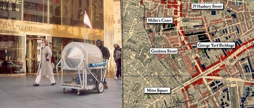
Krzysztof Wodiczko: Homeless Vehicle architecture.mit.edu www.we-make-money-not-art.com
Share
Gerelateerde thema's
Interessante ontwikkelingen die organisatiebreed worden behandeld.